
Security UX for Military Geospatial Operations
TL;DR:
Redesigned geospatial decision-support workflows for mission-critical operations so operators could triage, verify, escalate, and hand off AI-driven recommendations without losing map context. Made workflow state, ownership, and next actions explicit across roles. Validated in operator simulations and a military research event; visuals and quantitative metrics are redacted due to security constraints.
Note: Due to security constraints, production visuals and metrics are redacted. An illustrative mock is available upon request.
Problem:
Operators used a shared geospatial dashboard to coordinate time-sensitive actions across multiple roles. The system surfaced recommendations and signals, but it was unclear who owned them, what stage they were in, or what actions were valid next. That forced operators to infer responsibility and recovery paths across fragmented flows and inconsistent UI signals.
Design constraints
Multiple roles shared the same operating screen with different permissions and responsibilities
Operators needed to maintain map context while reviewing evidence and status
Critical signals needed to stay visible without cluttering the interface
Escalation, override, and reassessment workflows had to be explicit and recoverable
Handoffs needed continuity so the next operator did not reconstruct prior context
Primary pain points
Hard to see what needed attention first across competing signals
AI indicators were present, but ownership and verification steps were unclear
Escalation and override paths existed, but were difficult to follow mid-task
Operators lost context when switching views, shifting phases, or handing off work
How I Designed:
Reframed the command-and-control experience around the questions operators needed answered immediately:
What needs attention right now?
What changed in the operational picture?
What evidence supports action?
What is the next valid step for this role?
Then implemented interaction logic to make three things visible at all times: workflow state, responsible actor, and next actions, while preserving access to deeper evidence without leaving the map context.
Workflow Before and After
Before
Recommendations and AI indicators appeared in shared space without a clear owner
Verification, escalation, and reassessment steps were not legible from the active screen
Operators inferred authority, next steps, and recovery options from inconsistent signals
Reassessment required extra coordination because prior action and responsibility were not explicit
After
Recommendations routed to the appropriate role instead of showing as generalized prompts
Decision-critical information surfaced first, with evidence available on demand
Each recommendation made workflow state, responsible actor, and next actions explicit
Operators could verify, escalate, hand off, or loop back without restarting or losing map context
Reassessment improved because prior actions and ownership were visible within the workflow
Outcome:
Validated the redesign through operator simulations, 14+ research interviews, and review at a military research event. Quantitative metrics are redacted; outcomes below reflect observable workflow improvements.
Clearer ownership and responsibility for AI-driven recommendations
More explicit handoff points between roles and phases
Less friction in verify, escalate, override, and revisit paths
Better workflow continuity because operators acted from the current screen without losing context
These changes improved decision support under time pressure by making ownership, state, and recovery paths legible in the primary map workflow.

My Role:
Designed the interaction model for triage, verification, escalation, and handoff workflows across a shared geospatial dashboard. Defined ownership and state visibility patterns for AI-driven recommendations so operators could act without losing map context. I also conducted 14+ interviews and validated the redesign in operator simulations and a military research event.
What This Case Study Shows:
Demonstrates decision-support UX for geospatial, mission-critical workflows where role clarity, state visibility, and recoverability matter. The work focused on making responsibility explicit, presenting actionable next steps, and supporting reassessment and handoffs under time pressure without overwhelming operators.
Citation:
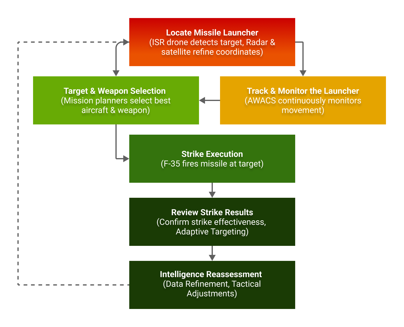
U.S. Air Force. (2023). Air Force Doctrine Publication 3-60: Targeting. Retrieved from https://www.doctrine.af.mil/Portals/61/documents/AFDP_3-60/3-60-AFDP-TARGETING.pdf
U.S. Air Force. (2024). U.S. Allies and Partners Integrate for Dynamic Targeting: Kill Chain Automation Exercise. Retrieved from https://www.7af.pacaf.af.mil/News/Article-Display/Article/3661445/us-allies-and-partners-integrate-for-dynamic-targeting-kill-chain-automation-ex/